GeoVantage ...Precision Navigated Imagery
GeoVantage ...Precision Navigated Imagery
3 Centennial Drive Suite 350
Peabody, MA 01960
3 Centennial Drive Suite 350
Peabody, MA 01960
Categories: Nonclassified Establishments 2, Surveying Services
Mapping and Aerial Surveying Services
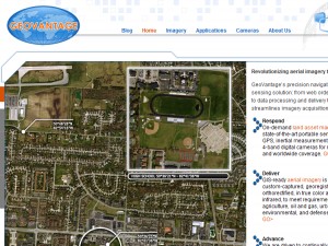
GeoVantage Inc. provides digital aerial imaging services worldwide for agriculture, oil & gas, forestry and environmental customers. State of the art equipment flown on small light aircraft for quick response and quick delivery of high resolution ortho rectified aerial imagery.
Keywords: Mapping, Aerial imagery, surveying
Customer Reviews for GeoVantage ...Precision Navigated Imagery
Be the first to review GeoVantage ...Precision Navigated Imagery - Use the thumbs to get started!
Click to Rate:


0 thumbs up, 0 thumbs down
0 thumbs up, 0 thumbs down
GeoVantage ...Precision Navigated Imagery has not yet completed their interview.
- ©2024 EssexCountyBusinessList.com
- Privacy Policy
- FAQ
- Contact
This site has been visited 5,830 times